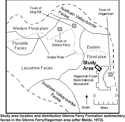
Labels:text | map | diagram | font OCR: Town of Northem Valley-border King Hill Facies Town of Hagerman WWW - - Western Flood-plain Fluviatile Town of - Glenns Ferry Facies Eastern Snake River Flood- plain Study - Lacustrine Facies Area - Hagerman Fossil Southem Valley-border Beds National Monument - Facies 0 - North Miles - Study area location and distribution Glenns Ferry Formation sedimentary facies in the Glenns Ferry/Hagerman area (after Malde, 1972).